

The deployment of autonomous navigation systems for urban delivery drones represents a significant advancement in logistics and urban mobility. This technology aims to overcome the inherent challenges of operating unmanned aerial vehicles (UAVs) in complex, dynamic, and populated environments. The “Robotics Revolution” in this context is not an overnight phenomenon but a carefully engineered evolution, building on decades of progress in artificial intelligence, sensor technology, and aerospace engineering.
Operating drones in urban environments presents a unique set of difficulties that autonomous navigation systems must address. Unlike open fields or controlled airspace, cities are densely populated with structures, moving objects, and unpredictable weather patterns.
Obstacle Detection and Avoidance
One of the primary hurdles is the ability of drones to perceive and react to their surroundings in real-time.
Static Obstacles
Buildings, trees, power lines, and other permanent structures pose constant threats. The drone’s sensors must be capable of identifying these objects and calculating safe trajectories around them. This requires sophisticated computer vision and LiDAR (Light Detection and Ranging) systems.
Dynamic Obstacles
The urban landscape is alive with movement. Vehicles, pedestrians, cyclists, and even birds introduce a layer of unpredictability. Autonomous systems need to not only detect these moving entities but also predict their future paths to avoid collisions. This involves sensor fusion, where data from multiple sensors (cameras, radar, ultrasonic sensors) is combined to create a comprehensive understanding of the environment.
Navigation in GPS-Denied Environments
While Global Positioning System (GPS) is a cornerstone of outdoor navigation, its reliability can be compromised in urban canyons.
Signal Degradation and Multipath Interference
Tall buildings can block or reflect GPS signals, leading to inaccuracies or complete signal loss. This “urban canyon effect” makes it difficult for drones to pinpoint their exact location, which is crucial for precise navigation and delivery.
Alternative Localization Techniques
To compensate for GPS unreliability, drones employ a range of alternative localization methods.
Visual Odometry
This technique uses cameras to track the drone’s movement by observing changes in the visual scene. By analyzing successive frames, the drone can estimate its displacement and orientation.
Inertial Navigation Systems (INS)
INS utilizes accelerometers and gyroscopes to measure the drone’s acceleration and angular velocity. When combined with other sensors, it can provide a more robust and continuous estimate of position and orientation, even when GPS is unavailable.
Simultaneous Localization and Mapping (SLAM)
SLAM algorithms allow a drone to build a map of an unknown environment while simultaneously keeping track of its own location within that map. This is a powerful technique for navigating unfamiliar or dynamically changing urban areas.
Regulatory and Safety Considerations
Beyond technical challenges, the operation of autonomous drones in urban airspace is heavily influenced by a complex web of regulations and safety protocols.
Airspace Management
Integrating a large number of drones into existing air traffic control systems requires sophisticated airspace management solutions. This involves designating flight corridors, setting altitude restrictions, and ensuring deconfliction with manned aircraft.
Sense-and-Avoid Technologies
Robust sense-and-avoid capabilities are paramount for preventing mid-air collisions with other aircraft, objects, and even birds. These systems act as the drone’s electronic “eyes,” constantly scanning the environment for potential hazards and initiating evasive maneuvers.
Fail-Safe Mechanisms
In the event of system failure, a compromised sensor, or loss of communication, drones must have pre-programmed fail-safe procedures. This can include returning to a designated landing zone, automatically initiating a controlled descent in a safe area, or alerting a remote operator.
In the context of the ongoing advancements in robotics, a related article titled “The Future of Urban Logistics: How Drones are Changing Delivery Systems” explores the implications of autonomous navigation technologies for urban delivery drones. This article delves into the challenges and opportunities presented by integrating drones into existing urban infrastructure, highlighting the potential for increased efficiency and reduced delivery times. For further insights, you can read the article [here](https://brainng.one/login/).
Core Technologies Enabling Autonomous Navigation
The realization of autonomous drone navigation in urban settings is contingent on the sophisticated integration of several key technological pillars. These systems work in concert, much like the interconnected organs within a living organism, to enable the drone to perceive, decide, and act.
Sensor Fusion and Perception Systems
The ability to accurately perceive the environment is the bedrock of autonomous navigation. This involves integrating data from multiple sensor types to create a comprehensive and reliable understanding of the drone’s surroundings.
LiDAR
LiDAR systems emit laser pulses and measure the time it takes for them to return after reflecting off objects. This generates a detailed 3D point cloud of the environment, providing precise distance measurements and shape information, essential for obstacle mapping and navigation.
Cameras (Visual and Thermal)
High-resolution cameras provide rich visual data, allowing for object recognition, lane following, and the identification of visual cues for navigation. Thermal cameras can detect heat signatures, aiding in the identification of people or animals in low-light conditions.
Radar
Radar systems use radio waves to detect objects and measure their velocity. They are effective in adverse weather conditions where optical sensors might struggle, contributing to robust obstacle detection and tracking.
Inertial Measurement Units (IMUs)
IMUs, comprising accelerometers and gyroscopes, measure the drone’s linear acceleration and angular velocity. This data is crucial for estimating the drone’s motion and orientation, especially during periods of GPS denial.
Localization and Mapping Techniques
Knowing where the drone is and understanding the layout of its environment are fundamental for path planning.
GPS/GNSS with RTK and PPK
While standard GPS can be imprecise in urban areas, Real-Time Kinematic (RTK) and Post-Processed Kinematic (PPK) techniques significantly enhance accuracy. These methods use differential corrections from ground stations to achieve centimeter-level positioning.
Visual Inertial Odometry (VIO)
VIO combines visual data from cameras with data from IMUs to estimate the drone’s pose (position and orientation) and build a map of its trajectory. It is particularly useful for short-term navigation and in environments where GPS is unreliable.
SLAM (Simultaneous Localization and Mapping)
SLAM algorithms are vital for creating and updating maps of the environment while simultaneously tracking the drone’s location within that map. This allows the drone to navigate unfamiliar territories and adapt to changes in its surroundings.
Pre-built Digital Maps
The use of highly detailed, pre-built 3D digital maps of urban areas provides a strong baseline for navigation. The drone can then use its onboard sensors to confirm its position against these maps and identify any discrepancies or dynamic changes.
Path Planning and Decision Making
Once the drone understands its environment and its own position, it needs to determine the best course of action.
Global Path Planning
This involves calculating an overall route from the origin to the destination, taking into account airspace regulations, no-fly zones, and known obstacles. Algorithms like A* (A-star) are commonly used for this purpose.
Local Path Planning and Replanning
As the drone moves, its perception of the environment is constantly updated. Local path planning allows the drone to make real-time adjustments to its trajectory to avoid newly detected obstacles or unexpected events. Dynamic Window Approach (DWA) and Model Predictive Control (MPC) are examples of algorithms used for this.
Reinforcement Learning and AI
Machine learning, particularly reinforcement learning, is increasingly being explored to train drones to make more complex decisions in dynamic and uncertain urban environments. This allows drones to learn optimal navigation strategies through trial and error, mimicking how a human might learn to drive in a busy city.
Autonomy Levels and Operational Scenarios
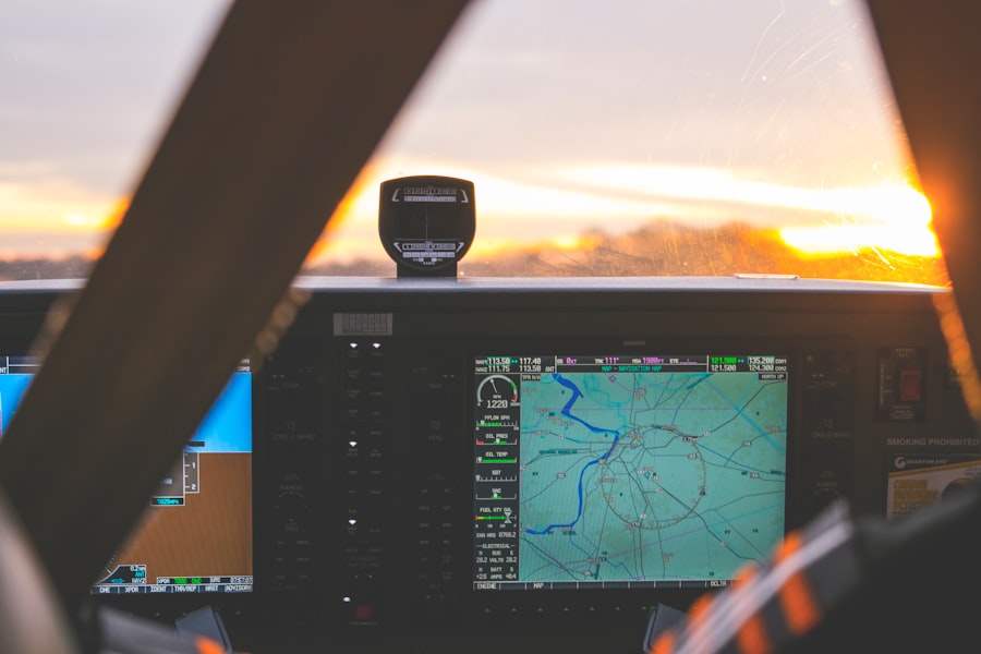
The degree of autonomy in urban delivery drones can vary significantly, influencing their operational capabilities and the complexity of their navigation systems. Understanding these levels of autonomy is crucial for appreciating the current and future potential of this technology.
Human Supervision and Remote Operation
At the lower end of the autonomy spectrum, drones may operate with significant human oversight.
Teleoperation
This involves a human operator directly controlling the drone’s flight path and actions from a remote location. While offering high precision, it is not scalable for large-scale delivery operations due to the bandwidth and human resources required.
Monitor and Intervention
In this scenario, the drone operates autonomously for significant portions of its flight, but a human operator monitors its progress and is ready to intervene if an anomaly is detected. This model is often seen as a stepping stone towards full autonomy, ensuring safety and providing a valuable feedback loop for system improvement.
Conditional and High Autonomy
As drones become more sophisticated, their autonomy increases, enabling them to handle more complex situations.
Conditional Automation
Here, the drone is capable of handling standard flight operations and routine tasks without human intervention. However, it may still require human assistance for complex scenarios, such as navigating highly congested areas or dealing with unexpected weather events.
High Automation
Drones with high automation can perform most driving tasks without human intervention, but may still require the human operator to be available to take control if a situation arises that the system is not programmed to handle. This could include dealing with ambiguous sensor readings or operating in unprecedented environmental conditions.
Full Autonomy
The ultimate goal for many in the field is to achieve full autonomy, where drones can operate independently and safely without any human intervention.
Unrestricted Operations
Fully autonomous drones would be able to navigate any urban environment, complete deliveries, and manage all aspects of their flight, from takeoff to landing, autonomously. This level of autonomy hinges on incredibly robust perception, decision-making, and fail-safe systems.
Fleet Management and Swarm Intelligence
At full autonomy, drones can be managed as a fleet, coordinating their movements and optimizing delivery routes collectively. This could involve concepts of swarm intelligence, where individual drones contribute to a larger, intelligent system, much like ants in a colony working towards a common goal.
Specific Delivery Use Cases
The application of autonomous navigation varies depending on the specific delivery needs.
Last-Mile Delivery
This is the most common application envisioned, where drones carry small packages from local distribution centers to customers’ homes or businesses. Precise navigation and the ability to safely land in diverse urban settings are critical.
Medical and Emergency Supplies
The rapid and reliable delivery of time-sensitive medical supplies, such as blood or organs, requires highly autonomous and efficient drones capable of navigating directly to hospitals or emergency sites.
Infrastructure Inspection and Monitoring
Autonomous drones equipped with sensors can be deployed to inspect bridges, power lines, and other urban infrastructure, providing data that would be difficult or dangerous for humans to collect.
Integration into Urban Infrastructure and Ecosystems
The successful integration of autonomous delivery drones into urban environments is not solely a technological challenge; it requires careful consideration of their interaction with existing infrastructure and the broader urban ecosystem. The drone is not an island but a component of a larger, interconnected system.
Vertiports and Takeoff/Landing Zones
Dedicated infrastructure will be crucial for managing drone operations.
Designated Flight Hubs
Similar to how cars utilize roads and parking lots, drones will require designated areas for takeoff, landing, and recharging. These “vertiports” or landing pads need to be strategically located to minimize noise pollution and ensure accessibility.
Automated Loading and Unloading
To maximize efficiency, these zones will likely feature automated systems for loading and unloading packages, reducing the need for human intervention and speeding up turnaround times.
Air Traffic Management Systems for Drones (UTM)
Managing a sky filled with drones requires sophisticated air traffic control specific to their operations.
Unmanned Traffic Management (UTM)
UTM systems provide a framework for managing drone traffic at low altitudes, distinct from traditional air traffic control for manned aircraft. These systems coordinate drone flights, deconflict airspace, and ensure safe separation.
Dynamic Airspace Allocation
As drone traffic increases, UTM systems will need to dynamically allocate airspace, creating temporary corridors and restrictions based on real-time demand and operational needs. This is akin to how traffic lights manage the flow of vehicles on roads.
Cybersecurity and Data Management
The autonomous nature of these drones makes them susceptible to cyber threats, and their operations generate vast amounts of data.
Protection against Hacking
Ensuring the security of drone communication, control systems, and navigation data is paramount to prevent malicious actors from hijacking drones or compromising their missions. Robust encryption and authentication protocols are essential.
Data Privacy and Usage
The data collected by drones regarding flight paths, delivery locations, and potentially even environmental information raises questions about privacy. Clear regulations and ethical guidelines will be necessary for the collection, storage, and use of this data.
Public Perception and Social Integration
The acceptance of drones by the public is a critical factor for widespread adoption.
Noise Pollution Mitigation
The sound generated by drone propellers can be a significant concern for urban residents. Ongoing research focuses on developing quieter propulsion systems and optimized flight paths to minimize noise disturbance.
Visual Impact and Aesthetics
The visual presence of drones in the sky could also be a concern. Design considerations and flight path planning can help to mitigate these impacts.
Education and Engagement
Open communication with the public, educational outreach programs, and demonstrating the benefits of drone delivery (e.g., faster delivery times, reduced traffic congestion) are crucial for fostering acceptance.
Power Management and Charging Infrastructure
The operational endurance of drones is directly tied to their power source and charging capabilities.
Battery Technology Advancements
Continuous improvements in battery energy density and lifespan are essential for extending flight times and reducing the frequency of charging.
Automated Charging Stations
Similar to electric vehicles, drones will require convenient and automated charging infrastructure, potentially integrated into vertiports or other urban nodes. This ensures that drones can quickly return to service.
In the context of the ongoing advancements in drone technology, the article on Robotics Revolution: Autonomous Navigation for Urban Delivery Drones highlights the innovative approaches being developed to enhance urban logistics. This piece delves into the challenges and solutions associated with navigating complex city environments, showcasing how autonomous drones can transform the delivery landscape. As cities continue to grow, the integration of such technologies promises to streamline operations and improve efficiency in urban transportation.
The Future of Urban Drone Delivery
| Metric | Description | Value | Unit |
|---|---|---|---|
| Average Delivery Speed | Typical speed of urban delivery drones during navigation | 45 | km/h |
| Navigation Accuracy | Percentage of successful autonomous navigation without human intervention | 98.5 | % |
| Battery Life | Average operational time per full charge | 35 | minutes |
| Payload Capacity | Maximum weight the drone can carry for delivery | 5 | kg |
| Obstacle Detection Range | Maximum distance at which obstacles can be detected | 50 | meters |
| Delivery Radius | Maximum distance from base station for delivery missions | 15 | km |
| Charging Time | Time required to fully recharge the drone’s battery | 60 | minutes |
| Flight Altitude | Typical cruising altitude for urban navigation | 120 | meters |
| System Uptime | Percentage of time the drone system is operational and ready | 99.2 | % |
| Delivery Success Rate | Percentage of deliveries completed without errors or delays | 97.8 | % |
The robotics revolution in urban delivery drones is still unfolding, with significant potential for future development. The journey from a nascent concept to a ubiquitous urban utility is paved with ongoing innovation and adaptation.
Advancements in AI and Machine Learning
The sophistication of AI will continue to drive improvements in drone capabilities.
Enhanced Predictive Capabilities
Future AI systems will be better at predicting the behavior of dynamic obstacles, such as pedestrians and vehicles, allowing for even smoother and safer navigation.
Adaptive Learning for Complex Scenarios
Drones will be able to learn and adapt to increasingly complex and never-before-seen urban scenarios through advanced machine learning techniques, becoming more robust in unpredictable environments.
Swarm Robotics and Collaborative Navigation
The ability for multiple drones to work together is a key area of development.
Coordinated Flight Paths
Drones will be able to coordinate their flight paths to optimize collective delivery efficiency, much like a flock of birds navigating together. This could involve dynamically adjusting routes based on the real-time status of other drones in the swarm.
Distributed Problem Solving
Issues that might be challenging for a single drone, such as navigating a highly congested area, could be solved collaboratively by a swarm, with each drone contributing to the overall solution.
Regulatory Evolution and Standardization
As the technology matures, regulations will likely evolve to accommodate widespread drone usage.
Global Standards Development
The establishment of international standards for drone operation, safety, and navigation will facilitate broader deployment and interoperability.
Streamlined Approval Processes
As the safety and reliability of autonomous navigation systems are proven, regulatory bodies may streamline the approval processes for drone operations.
Integration with Smart City Infrastructure
Drones will become an integral part of a larger, interconnected smart city.
Data Sharing with City Systems
Drones could share anonymized data with city management systems to provide real-time insights into traffic flow, environmental conditions, and urban activity.
Integration with Autonomous Vehicle Networks
Future autonomous delivery drones could coordinate with self-driving cars and other autonomous mobility solutions to create a seamless logistics network.
New Delivery Paradigms
Beyond simple package delivery, autonomous drones could enable entirely new logistical models.
On-Demand Mobile Services
Imagine drones acting as mobile service providers, delivering tools, supplies, or even specialized equipment directly to work sites or individuals in need.
Dynamic Replenishment of Urban Assets
Autonomous drones could be tasked with automatically replenishing essential supplies at various points within the urban landscape, ensuring continuous availability of goods.
The “Robotics Revolution” in urban delivery drones is not just about carrying packages; it is about fundamentally reshaping how goods and services are moved within our cities. The silent hum of these machines navigating our skies, governed by sophisticated autonomous systems, promises a future of increased efficiency, reduced congestion, and novel logistical possibilities. While challenges remain, the trajectory of technological advancement suggests that autonomous navigation for urban delivery drones is poised to become a cornerstone of the 21st-century city.